If you want to know about the submission drawing or toilet detail or miscellaneous detail, please click the link.
A grading layout plan is a document that shows how the land will be graded and shaped during the construction process. It typically includes contour lines to indicate the elevation of the land at various points, as well as information about drainage, utilities, and other site features.
The grading layout plan is an important tool for the construction team, as it helps them to understand the topography of the land and plan for the excavation and fill work that will be required to create a level building site. It also helps to ensure that drainage is properly handled and that the site is properly prepared for the construction of the building and any other structures or landscaping that will be included.
The grading plan layout is typically created by a civil engineer, who will use data from a survey of the land to create a detailed map of the site. The plan will be reviewed and approved by the local building department before construction can begin.
A typical grading plan layout should include:
- Contour lines, which show the elevation of the land at various points and help to indicate any areas of the site that may need to be filled or excavated.
- Drainage features, such as stormwater management systems and swales, which are used to channel water away from the building and prevent flooding or erosion.
- Location of Utility lines- Water, Sewer, Gas and Electric
- Existing and proposed slopes
- Ramps, stairs and sidewalks for accessibility
- Building and structures location
- Location of any Retention or detention ponds.
It’s also good practice to use symbols and legend to make the plan clear and easy to understand.
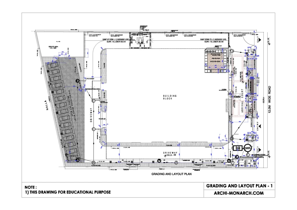
Image of gradings and layout plan detail and downloadable (in DWG) link below

Gradings and layout plan detail drawing – 1
A grading layout plan detail drawing is a detailed, highly technical drawing that provides specific information about the grading and shaping of the land in a particular area of a construction site. This type of drawing is typically created by a civil engineer or a land surveyor and is used to guide the excavation and fill work that is necessary to prepare the site for construction.
The grading layout plan detail drawing will typically include detailed information about the contour lines and elevations of the land, as well as information about drainage, utilities, and other site features. It will often include cross-sections, profiles, and other views that provide a more in-depth look at the site.
A grading layout plan detail drawing should include the following information:
- Contour lines with elevation indicated
- The location of utilities such as water, gas, and electricity
- The location of drainage features, such as catch basins, swales, and stormwater management systems
- The location and design of any retaining walls, cut and fill areas
- The location of any structures, including buildings, sidewalks, ramps, and stairs
- The location of existing and proposed slopes
- The details of any retaining or detention ponds
It’s important that a grading layout plan detail drawing be clear and easy to understand, with all elements and information clearly labeled and dimensioned. They should be checked by a professional for any errors or inconsistencies and be updated as the work progress.
Our tips to help you improve your architectural grading and layout plan detailing.
