

Description
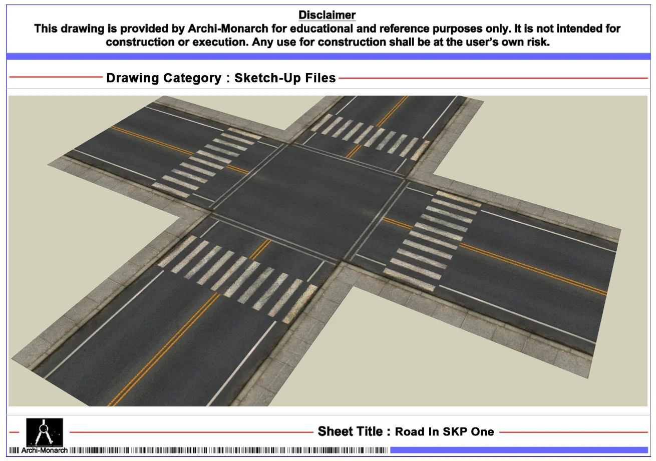
The Road In SKP is a professionally prepared SketchUp file in SKP format. It is designed for educational and reference purposes. Roads are essential elements in site planning and urban design. Therefore, they define movement, access, and connectivity within a project. As a result, designers use them to organize circulation and improve overall layout efficiency.
This SKP file provides a detailed 3D model of a road element. In addition, it suits residential layouts, commercial developments, town planning projects, and landscape designs. The model includes clean geometry and organized components. Furthermore, it allows users to modify width, materials, and alignment. Moreover, it helps define vehicular movement, pedestrian flow, and site accessibility. Consequently, users can create accurate and realistic site models.
Moreover, the file follows professional architectural and urban modeling standards. It maintains proper scale, clean edges, and efficient geometry. As a result, it ensures clarity and smooth workflow. Therefore, students can easily understand site circulation and road integration concepts. Similarly, professionals can improve modeling efficiency and presentation quality. The file remains fully editable, so users can customize it as needed. In addition, they can adapt it to suit different site conditions and project requirements.
The SKP format ensures compatibility with SketchUp and similar 3D modeling software. Thus, users can import and edit the model easily. This also helps save time and improve workflow efficiency. Furthermore, it supports better coordination with CAD drawings and rendered outputs.
This road SKP file fits many project types. For example, designers use it in residential layouts, commercial complexes, landscape designs, and urban planning projects. Overall, it supports both academic learning and professional 3D modeling work.
Key Highlights:
- Road SketchUp file in SKP format
- Intended for educational and reference use only
- Includes clean and detailed 3D geometry
- Suitable for site planning and landscape modeling
- Helps define circulation and accessibility
- Fully editable and easy to customize
- Compatible with SketchUp and similar software
- Suitable for students and professionals
This file is not a construction-ready document. Therefore, always consult qualified professionals before using it in real projects.







Reviews
There are no reviews yet.